 vesseltracker.com
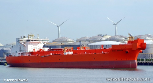
Vessel EAGLE BARENTS IMO: 9676125, MMSI: 257980000 Crude Oil Tanker
UTC, 51.95275, 4.13113, course: 358, speed: 0
2026-01-22 11:31:54 UTC, 51.95274, 4.13114, course: 358, speed: 0
Live AIS position:
UTC. Near HOEK VAN HOLLAND),
updated 2026-01-22 11:31:54 UTC.
Find the position of the vessel EAGLE BARENTS on the map. The latter are known coordinates and path.
marine traffic ship tracker show on live map
The current position of vessel EAGLE BARENTS is 51.95274 lat / 4.13114 lng. Updated: 2026-01-22 11:31:54 UTCCurrently sailing under the flag of Norway (NIS)
EAGLE BARENTS built in 2015 year
Deadweight:
119690 tDetails:
Last coordinates of the vessel:
UTC, 51.95276, 4.13111, course: 358, speed: 0UTC, 51.95275, 4.13113, course: 358, speed: 0
2026-01-22 11:31:54 UTC, 51.95274, 4.13114, course: 358, speed: 0